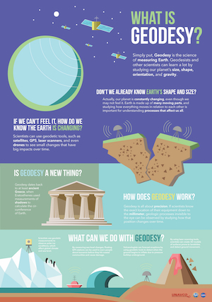
We can measure the Earth precisely thanks to geodesy, the study and measurement of the Earth’s rotation, exact shape, and gravity.
Geodesy is an ancient science that started with Eratosthenes, who first calculated the circumference of the Earth by comparing the angles of shadows thrown by the sun at two different locations. Geodetic VLBI was first used in the 1960s, and the technology and resulting accuracy have been refined and improved ever since then.
The IVS contributes to geodesy via measurements used in geodetic VLBI, an extremely accurate technique for making high-precision global measurements of the speed and angle of the Earth’s rotation to millimeter accuracy. VLBI also allows measurement of tectonic plate movement.
| VLBI is also important in astronomy and astrometry. In astronomy, VLBI is commonly used to image distant radio sources, such as the black hole M87. The Event Horizon Telescope (EHT) project used VLBI to obtain the first image of a black hole in early 2019. VLBI is also used in astrometry to accurately measure the distances and positions of stars and other celestial objects. |
Measuring the Earth: shape, orientation, and gravity
In geodesy, VLBI is used to make measurements from pairs of radio telescopes of an extragalactic object such as a quasar that—from Earth—appears at a fixed point in space. The measurements are time-coded via hydrogen maser clocks. By measuring the exact distance of each radio telescope from a fixed object at the same moment, VLBI allows scientists to determine the precise position of each station. These accurate location measurements enable geodesists to calculate the rotation of the Earth. Knowing how fast the Earth is rotating is essential to maintaining an accurate measurement of Universal Time (UT1).
Data from IVS observations contributes to the calculation of the International Terrestrial Reference Frame (ITRF) and the International Celestial Reference Frame (ICRF), which are reference systems that provide coordinates of points on the Earth’s surface and in space. These systems are crucial for navigation and communication as a set of common references points that are continually updated.
Tectonic plate motion
Geodetic VLBI also allows scientists to measure the movement of the Earth’s tectonic plates extremely accurately. VLBI measurements of the distance between the radio antennas at Westford, Massachusetts, and Wettzell, Germany, show that North America and Europe are separating at a steady rate of about 17 millimeters per year. Scientists also use geodetic VLBI to measure changes in the position of the San Andreas fault in California, as the Pacific plate slips past the North American plate at the rate of about 5 centimeters per year.
Resources on geodesy and VLBI
Visit these other excellent sites to learn more about VLBI and many of its implementations, as well as groups related to the IVS:
UNAVCO: geodesy education https://www.unavco.org/education/education.html and science https://www.unavco.org/science/science.html
GFZ Potsdam: geodetic and astrometric VLBI explanation https://www.gfz-potsdam.de/en/section/space-geodetic-techniques/topics/geodetic-and-astrometric-vlbi/
NASA’s Space Geodesy Project (SGP): https://space-geodesy.nasa.gov/
European VLBI Group for Geodesy and Astrometry (EVGA): http://wp.portal.chalmers.se/evga/
European VLBI Network (EVN): https://www.evlbi.org/home